About Us
![]() MapRun was developed by Peter Effeney with the support of Orienteering Australia, and locally is supported by North Gloucestershire Orienteering Club
MapRun was developed by Peter Effeney with the support of Orienteering Australia, and locally is supported by North Gloucestershire Orienteering Club
![]() Our events are registered with British Orienteering.
Our events are registered with British Orienteering.
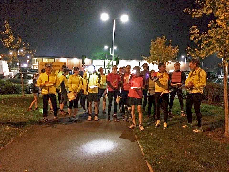
We are keen to introduce runners to navigating – it’s nothing to be scared about (except in the dark!) and we are keen to make your first experience a fun one. We’ll have “experts” on hand at our evening events to provide advice and guidance, and answer any questions you may have. We are also willing to run “pop-up” events (informally) if any large group requests 🙂 It’s easiest to message us via our Facebook page.
How does it work?
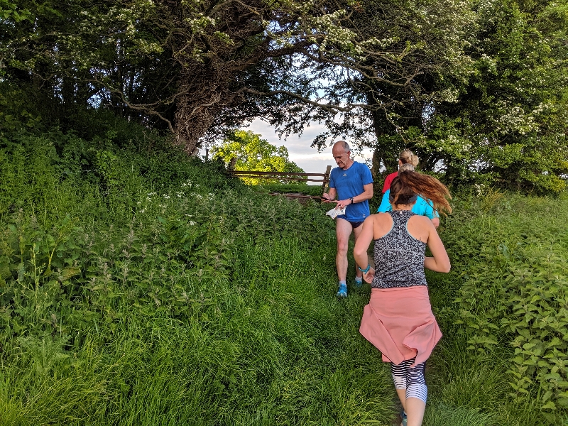
Maprun is a run where you decide the route!
- You have 60 minutes, and a map with 30 checkpoints to visit.
- Your goal: to score points by visiting checkpoints. Score as many points as you can, and get back to the start within the time limit.
- You can choose which checkpoints to visit, in any order, via any route.
Speed is an advantage, but the fastest runner won’t necessarily come out on top. It’ll take smart planning to find the shortest route worth the most points.
- Your route is recorded by the free Maprun app, available for Android and iPhone.
- The app automatically records each checkpoint you visit: it will bleep to tell you it has registered.
- You can use the map provided on the app, or print a paper map and store your phone away.
- Once you’ve finished, the app will upload your route, so you can compare your results with everyone else.
See Getting Started for help setting yourself up.
Where?
We have over 30 courses across Gloucestershire. You can run these any time: just head to the start location, select the course on the app, and you’re good to go. You can find a map and list of courses on the Courses page.
Events
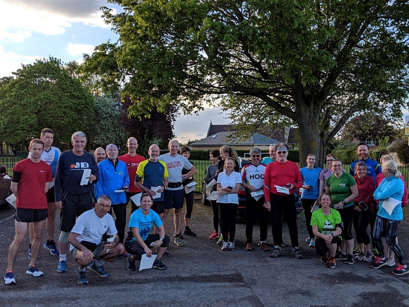
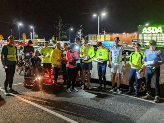
About once a month, we add a new course to our catalogue and hold a launch event: these events take place at 7pm, and are open to all. Most of our winter 2019-20 events are on Wednesday evenings. It’s a good chance to test your route choices against lots of other people running at the same time.
Understanding the Map
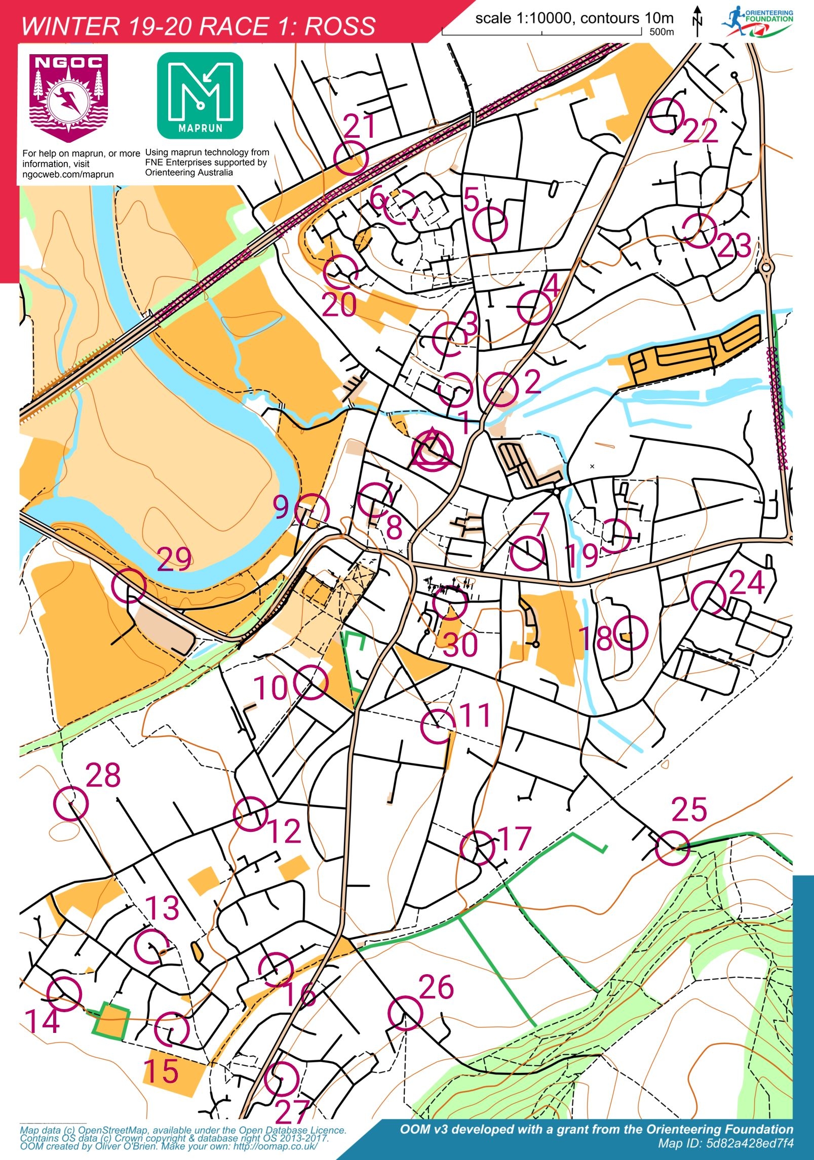
On the left is a sample map from Ross-on-Wye. The colours will seem a little confusing at first but you will get used to it!
In general, solid black lines are roads, dashed black lines are tracks and footpaths. “Bigger” roads may be coloured pale browny/pink with black outlines. Areas of pale browny/pink are normally car parks.
Black and white lines are railways – these are forbidden to access.
Water features are blue – in general these must be avoided. DO NOT take un-necessary risks with deep water
Dark green lines are hedges, used to mark out field boundaries and gateways. Areas of green are woodland. Often you can go “cross country” here rather than stick to paths, but the terrain can be variable. Yellow areas are normally grassy land – you do not normally have to stick to paths and can run right across these. Lastly, white is “undefined” – please assume you have no access to these areas as these are normally private gardens etc.
The pink circles are the locations of the “virtual checkpoints” you aim is to visit. The start and finish location is the double circle with triangle.
Some maps feature pink hatches (criss-cross), or “X”, these areas are strictly forbidden as judged by us – either for safety or in respect of the landowner. Note you have no specific permission to enter private property.
The maps are aligned such that grid north is always aligned as “up”, and map scale is 1:10,000 – i.e. 1km on the ground is 10cm (4in) on the map. Please think about this when you estimate what distance you will cover in 1 hour!
Course Format
Maprun courses all have the same basic rules:
- You have a 60 minute time window, and a map with 30 checkpoints to visit.
- The 10 lowest-numbered checkpoints are worth 10 points.
- The 10 middle-numbered checkpoints are worth 20 points.
- The 10 highest-numbered checkpoints are worth 30 points.
- You can visit whichever checkpoints you like, in any order, via any (legal!) route.
- If you go over the time limit, you’ll start to amass penalties – make sure you’re back at the finish in time!
Want to try more?
As well as maprun events and courses, We, North Gloucestershire Orienteering Club (NGOC) run a full programme of standard orienteering events at which you can develop or navigation skills, or just have some fun running around the forests and towns of the Cotswolds and Forest of Dean. In Winter we tend to be off-road, and sometimes include longer trail courses alongside our standard orienteering courses, and in the Summer we are usually to be found in urban and suburban terrain towns and suburbia. You can find out a lot more about what we do, and can subscribe to our mailing list, by visiting the NGOC website at www.ngoc.org.uk.
Insurance
Please note that third party liability insurance for individuals extends only to members of British Orienteering – all others compete at their own risk. Regular Maprunners are encouraged to North Gloucestershire Orienteering Club and British Orienteering.
Individual competitors running in their own time run at their own risk and MapRun, North Gloucestershire Orienteering Club and British Orienteering take no responsibility for any damage or injury whilst competing.