Mallards Pike Jogging Trails
These trails are maprun versions of the Forestry Commission 5 and 10Km jogging trails starting and finishing at Mallards Pike. The FC trails are in fact slightly longer than the nominated distance, and the waymarks are at approximate but not precise Km marks. The maprun courses start from the Forestry Commission Start post, and use the same waymarks for intermediate split times, but they finish on the 5 and 10km marks, so you can expect the timed run to finish in the app some way before you get to the Forestry Commission Finish, which is co-located with the Start post. There is no marker post for either Finish, but the maprun app should detect the finish point and stop the clock. See below for details of the starts and finishes.
Both routes are well way-marked, so there is no need for a map of these routes, though maps are available for download if you wish.
If you enjoy running these trails, and fancy something a bit more challenging, requiring simple navigation and a bit of variety in the routes you run, have a look at the huge range of maprun courses we have around Gloucestershire and neighbouring areas. All you need is a smartphone!
Parking is in the Forestry Commission Pay and Display car park at Mallards Pike. Please don't forget to pay!
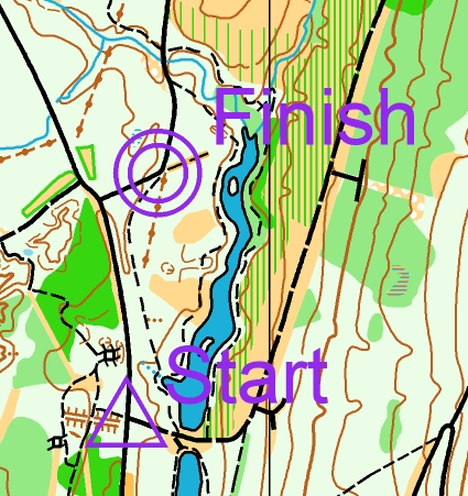
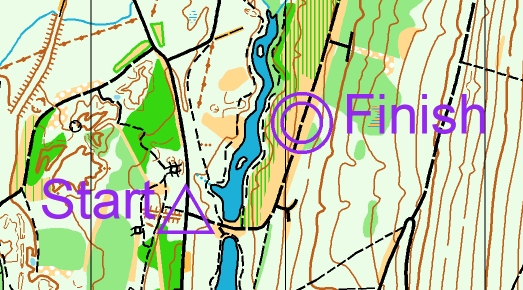
The Start for each trail is on the main track past the cafe towards the Go Ape base. The start post is on the left side of the track just before the first main track junction.
 The 5km finish is on the wide and final bend after the long run down from the 4km mark, just before you get to the main track along which you headed off from the start.
 The 10km finish is about 250m before the Forestry Commission finish post, and midway between the two prominent spur tracks on the last straight run down to the lake crossing.
| 5Km Trail Map 10Km Trail Map |
| 5Km Leader Board 10Km Leader Board | 5Km Tracks 10Km Tracks |