Checking Maprun with QuickStart
A good way to check if you are correctly set up for maprunning is to use the QuickStart facility to plan and run a short course around your house, or somewhere convenient nearby. This page walks you through the process of creating a QuickStart course, and getting ready to go out and run or walk it.
Click on the links in the procedure below to see maprunf screen samples.
- Open maprunF on your phone. You will see the main maprun screen
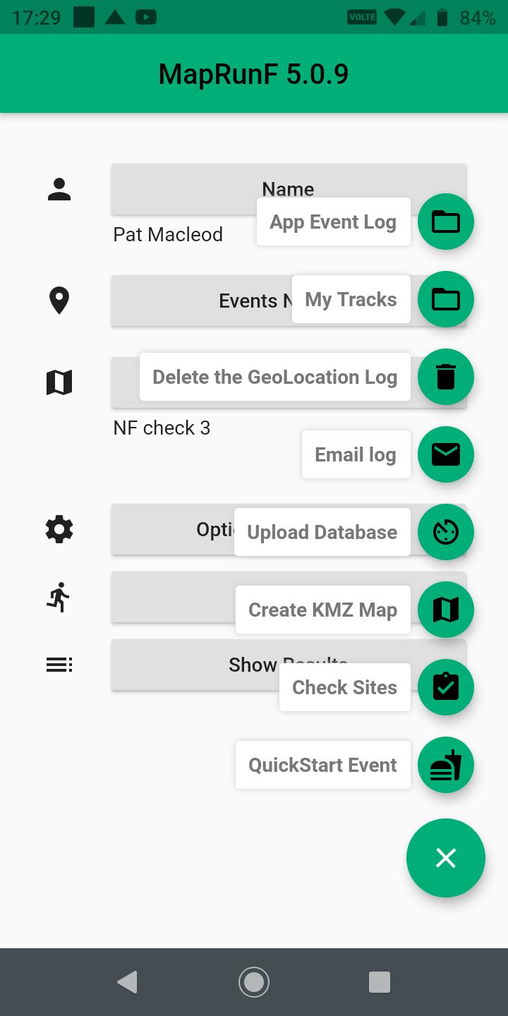
- Tap the green menu button at the bottom right of the screen, and you will see the menu
- Tap the QuickStart icon
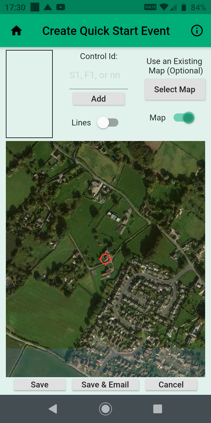
- QuckStart will try and establish your location, and will display a course setup screen. The red circle wll be centred on your current location. It will remain there throughout the process. You simply drag the background map around with your fingers, zooming in and out as necessary, to define a course.
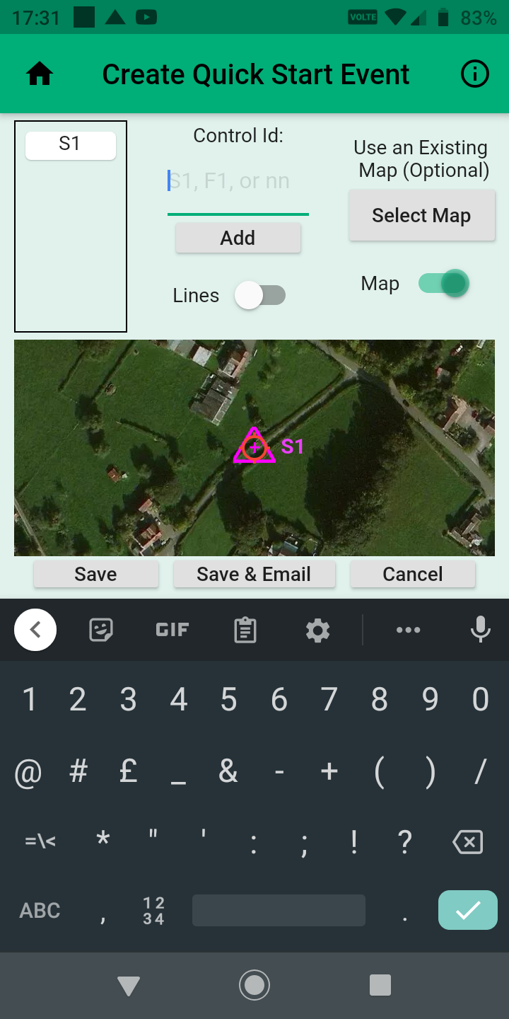
- Drag the map so that the red circle is over your proposed Start. Then type S1 (must be upper case S) in the Control ID field, and tap Add. Your Start will be positioned at the red circle, and will be listed as S1.
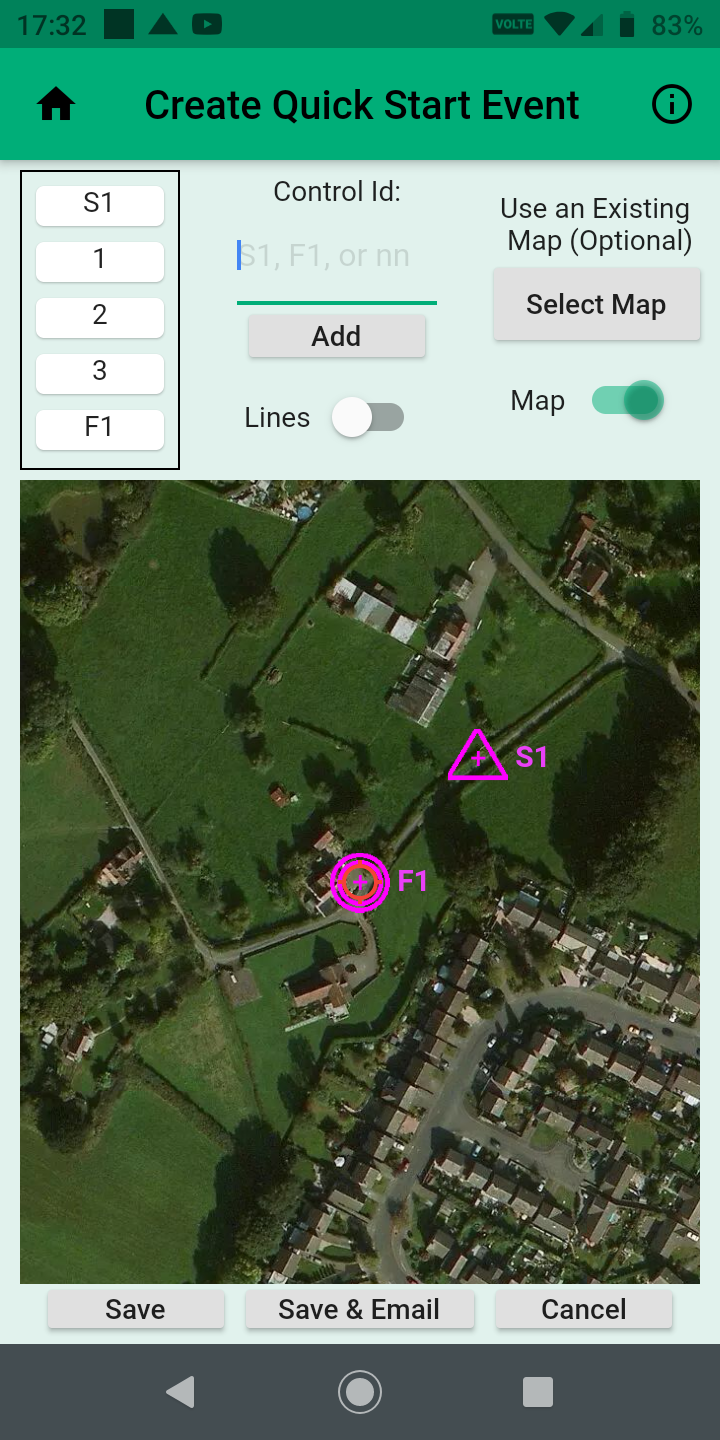
- Now you can scroll the map to each control in turn, numbering them as you wish, and adding each to the list in the top left corner of the screen. Finally, add the Finish, which must be the last control, numbered F1.
- Now you can save the course by tapping the Save button, and give it a name. The course will be saved to your phone, and will be available to run until you choose to delete it. Once saved, maprunF will display a list of all the courses saved on your phone. Your new course will be in there somewhere, or will be the only one if your first attempt at maprun. The next step is to go an give it a try. Tap the course name, and it will loaded into the app as the current event. Now tap Options and Settings.
- You will see a display of the options and settings that you may be able to adjust for the course. Many are fixed, and not changeable for Quick Start, or by the runner, but there are are two which can be changed, and which are very useful when checking things out on your first go at maprun. Theses are 'Display Present Location' and 'Show Track'. Slide the little slider thingies to enable these two settings. Now, when you go out on the course, you'll be able to see where you are at all times, and will be able also to see how accurately the phone's location system is tracking your movement. Then just tap the back arrow top left of the screen, and you are ready to go.
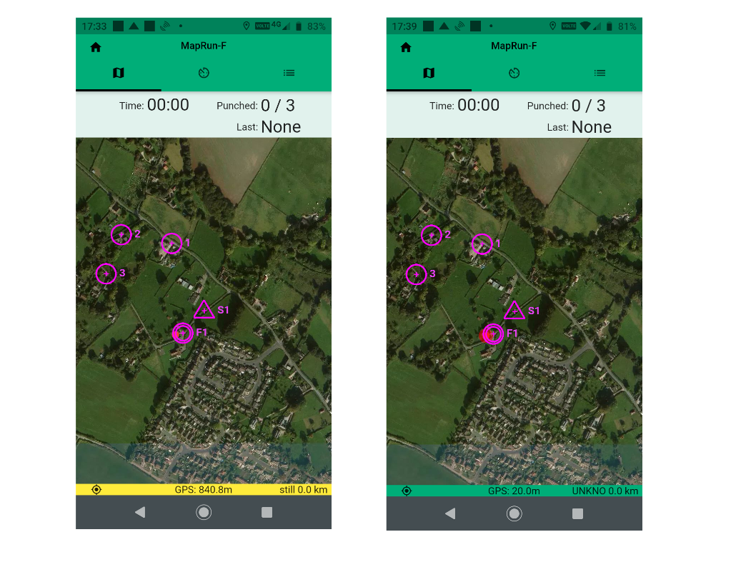
- Tap Go to Start. You will see the course, with details at the top of the screen. At the bottom of the screen is a GPS status line. If it is red, or yellow as in the left hand image of the two shown, the GPS is either not running with the app, or is locating itself. Once the status bar turns Green, the app is running with location service enabled and ready to go. In the centre of the status bar is a GPS accuracy measure, which should normally be in single figures. All this of course assumes that you are somewhere where the phone can pick up the GPS service at all. If indoors, it may not, and so you may have to go outsside to let it locate enough satellites to position you. Once the status bar is green, you can and try out the course.
If all this works, there is no reason why maprun will not work for you when you go to a maprun event, or to run one of the many courses we have around the area. Of course, technology being what it is, it might not, but generally speaking if the phone is set up correctly, and you have a location, maprun will work fine.